Creating a route using the Cycling by Route map
Maps created using cycling map routing
Imagine that the route we are interested in is from New Brighton to CPIT (the PolyTech)
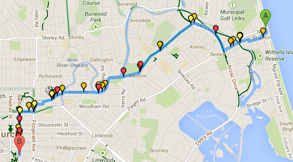
I create a route across the map using the right click menu or the locations at the top right of the screen. The data is presented along that map with the pins coded showing black=fatal, red=severe, orange=minor, yellow=no injury. I have set the date criteria to be from 2000 to present day
Route 1 – Google Car option.
8.8 km, 83 crashes (0 fatal, 5 severe, 57 minor, 21 no injury)

Route 2 – Google default Bike Option
10.0 km, 49 crashes (0 fatal, 8 severe, 33 minor, 8 no injury) which is about 40% reduction from Route 1. The Google bike preference gives a better route on safer streets, but slightly longer (10%)

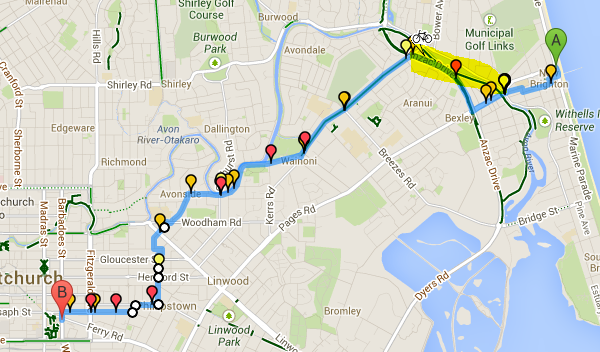
Route 3 – Google Bike Option route modified by user with some trial and error
10.1 km, 34 crashes (0 fatal, 7 severe, 21 minor, 6 no injury) which is a further 30% reduction over Route 2, or better than 60% over Route 1

There are still further improvements to avoid a couple of busy roads. Note the yellow highlight where google map routing won’t let the routing engine use the marked bike path. Not quite sure what the problem is there, but a cyclist with local knowledge can often work this out.
Viewing all the Crash Data
Viewing all the crashes in the route vicinity for help with route choice (grey are off-route)

Christchurch exceptions - look at the Traffic Management Plans
Christchurch has a particular problem with earthquake related road works, so it is worth considering the ever changing road restrictions for route planning. These road restrictions are known as TMP (Traffic Management Plan) data from NZTA, and are another data source that we have been working with. See Christchurch Road Works